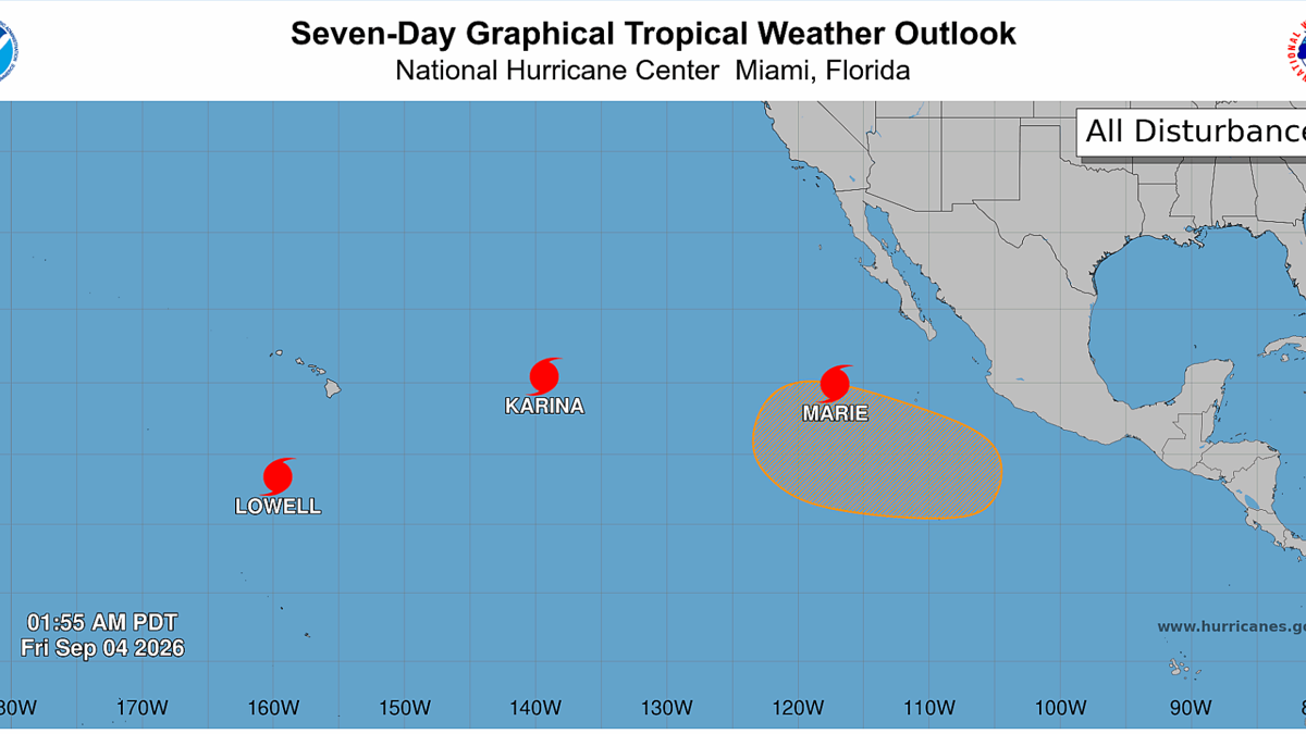
Three Pacific hurricanes are currently churning up the Pacific, the first time a weather event of this magnitude has happened since 1974.
Hurricanes Karina, Lowell and Marie are currently active, all moving between W and NW away from the coast of Mexico. Both Karina and Marie are making their way towards Hawaii while Lowell currently sits to the south of the islands.
This marks an exceptionally busy storm season for the Pacific, with the Northeast Pacific having produced 15 named storms and six hurricanes, well above the norm for this point in the season.
Meanwhile, the Atlantic basin, is suffering under unfavorable wind shear conditions, and has only produced five named storms and no hurricanes.
“El Niño typically enhances hurricane activity in the eastern and central Pacific basins because of the unusually warm water temperatures it brings to those parts of the ocean,” NASA explained via a press release. “It tends to suppress hurricane activity in the Atlantic basin by shifting large-scale circulation patterns in a way that makes it harder to sustain storms there.
“Of the three, Lowell became the strongest, with winds reaching category 5 strength for several hours on September 2. Around the same time, Karina, spinning a few thousand kilometers to the east, achieved category 4 strength, a rare case of category 4 and 5 hurricanes occurring simultaneously in the area. Marie, spinning southwest of Baja California, was still a tropical storm when the image was acquired but was strengthening as it moved northwest.”
Over in the Atlantic, Edouard, a short-lived storm made landfall over Louisiana and Texas. We’ll keep you posted on all storm activity.
Related: El Niño Likely to Be Strongest Ever On Record: Here’s What It Means For Surfing