UPDATE (May 23rd)
It’s Coming…
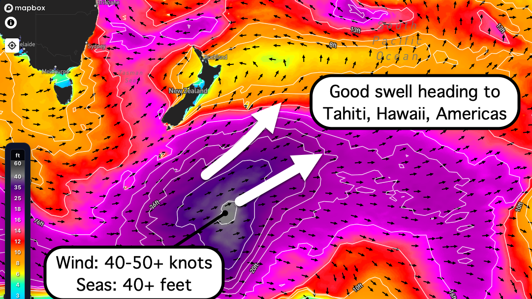
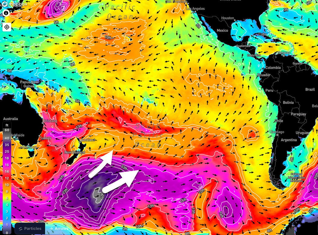
A powerful storm system is currently underway in the Southwest Pacific. Satellite data has confirmed sustained wind speeds of 40–50+ knots within a large, well-aimed fetch, whipping up wave heights within this fetch in excess of 40 feet. As a result, a significant swell will spread across the basin and light up many zones along it’s path.
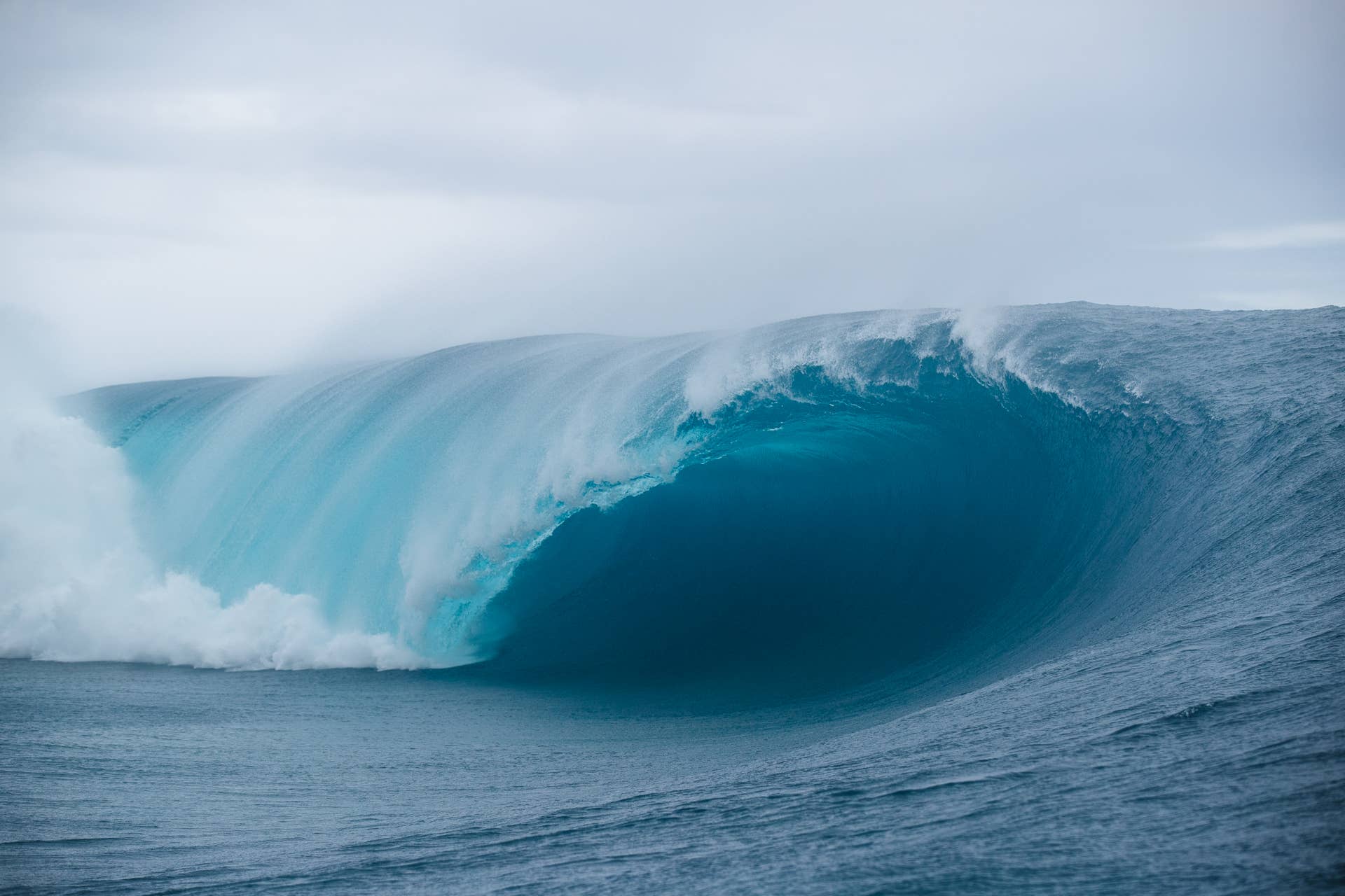
TAHITI: Waves to go XL at Teahupoʻo May 26–27
The size, period, and angle of this swell will have the world renown Teahupo’o going off. Long period energy will build in rapidly over Tue 26th from the SSW (210-190°), with the biggest waves (with sunlight) to be seen late in the day, as the swell is scheduled to top out that evening/night.
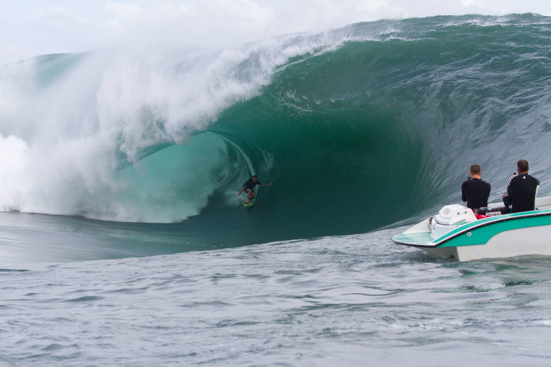
The surf on Tue 26th will already be solidly overhead in the morning at Teahupo’o, but watch for the bigger sets to eventually climb to 15-20 feet on the face, occasionally bigger. Mostly a paddle size swell through much of the day, but gradually becoming mostly tow size over the afternoon and evening (biggest just before dark). Strong surf continues into Wed 27th, but on an easing trend by this point. Note – there is more sizable swell to follow later in the week.
The local wind forecast has improved a little since previous projections, which wasn’t all that bad to begin with. At this time, offshore wind and clean conditions are in the cards — moderate easterly trades to show on Tuesday, then veering straight offshore from the ENE by Wednesday.
HAWAII: Sizable, clean surf May 29-31 and beyond
After slamming Tahiti, a decent share of this swell energy (200-180°) will find it’s way to Hawaii by Friday and the weekend of May 29th-31st. Many exposures along the southern shores are to offer at least chest-head high surf during the height of this run, with standouts going overhead, even a few feet overhead or so for select magnets. Meanwhile, the typical ENE trade winds will provide great conditions across the summer spots. NOTE – more pulses are to arrive for the first week of June to keep good surf elevated.
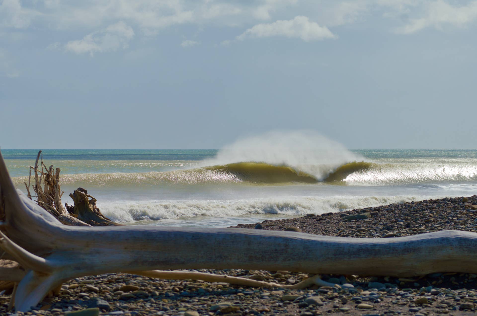
AMERICAS: Solid surf for Central America and Mexico, California’s summer spots light up as well
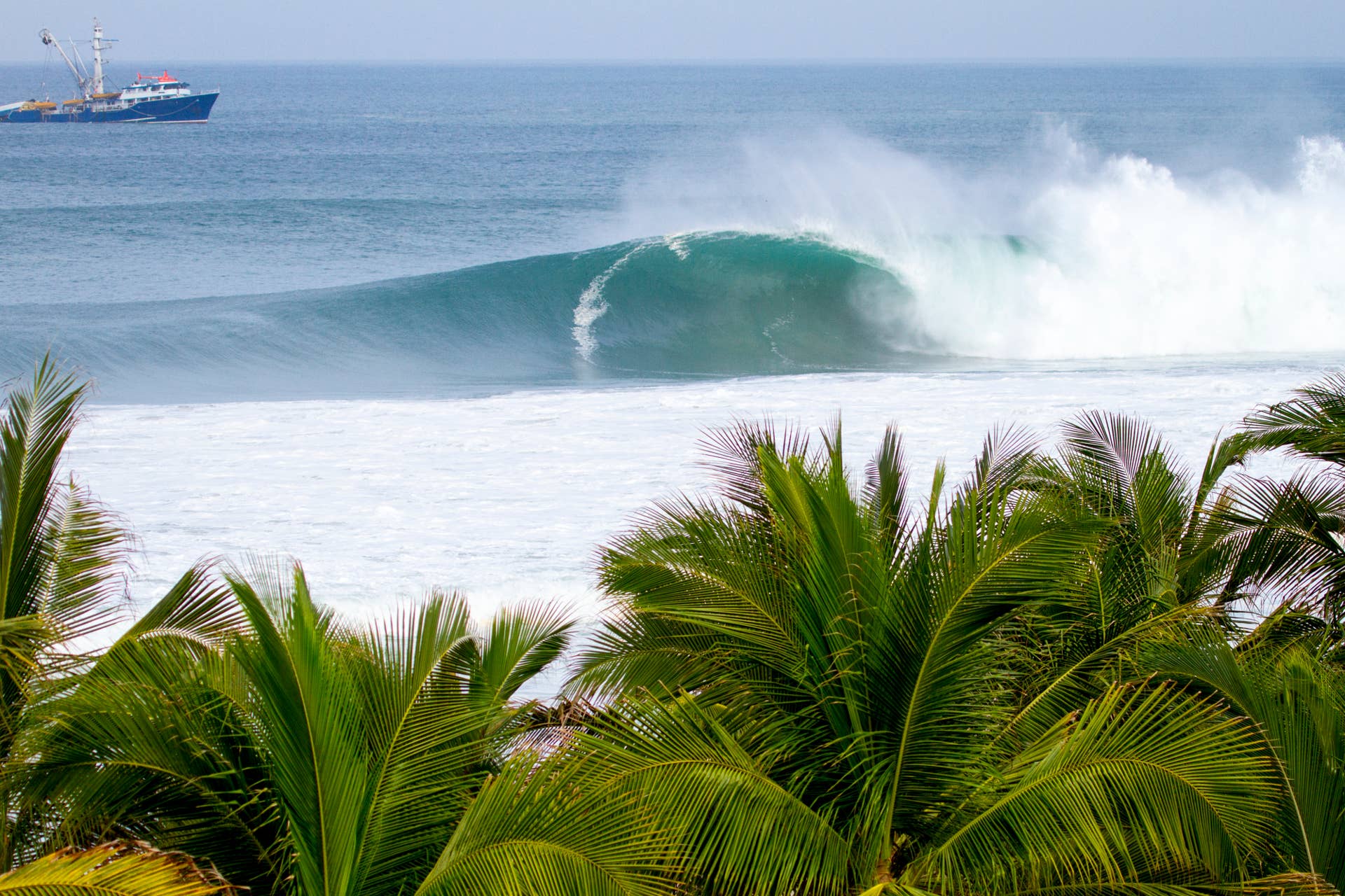
The rest of May is already booked up with fun Southern Hemi swell for the Americas, even some windows with pretty sizable surf for standout breaks south of the border. However, the featured swell is due to move in by the start of June, which will spike surf into the solid range for many.
Long period forerunners of SW-SSW swell (215-200°) will start to creep in over the last weekend of May, especially through Central America and Mexico. This energy will move in fully for June 1st through the 3rd, providing head high to overhead surf across the better exposures. Standouts will produce sets up around the double overhead mark, while select breaks see even larger waves on occasion. A freak magnet like Puerto Escondido, Mexico is looking at sets reaching 15-20+ feet on the face, occasionally bigger.
For most areas along the west coast of the Americas, the cleanest and most favorable wind conditions are expected during the morning hours each day. Then a seabreeze is likely to develop by the afternoons.
___________________________________________________________________________________
NOTE – Below is the original forecast outlook from May 20th
Target strike? If you’re in a position to do so, now may be the time to start dropping hints to your boss and checking on flights. For those already committed, the excitement is building. While it’s always smart to wait for the storm and swell to fully develop before locking in plans, confidence continues to increase that this event will deliver, as forecast models have remained impressively consistent.
A series of storms is set to track across the South Pacific through the rest of this week and into next week, but one system in particular stands out as the main swell producer to watch. Over the coming days, this storm is forecast to move out from beneath New Zealand and rapidly intensify into a massive, powerful low-pressure system in the Southwest Pacific (see image below).
Below is a quick outlook for a few zones for this upcoming swell event. Note this is how things are shaping up at this point, and are subject to change pending progress of the soon-to-develop storm/swell.
TAHITI: Solid and a little windy, but OK
Although the storm will not be perfectly aimed at Tahiti, the fetch orientation still looks highly favorable for a strong swell event. Given the storm’s massive size, intense winds, and relatively close proximity to the islands, a solid SSW swell (210–190°) is expected to develop for Tahiti and French Polynesia.
Surf is forecast to steadily build through Tuesday the 26th, peaking Tuesday night before gradually easing through Wednesday the 27th. Expert-only breaks like Teahupoʻo are expected to see powerful double- to triple-overhead sets during the peak of the event, with the largest waves potentially reaching 15–20+ feet on the face — especially late Tuesday into early Wednesday. Consistency should be good.
Trade winds are expected to remain fairly breezy throughout the swell event, but overall wind direction appears favorable for southwest-facing reefs in Tahiti. Side-offshore ESE winds are forecast for Tuesday, before veering more easterly and offshore on Wednesday, helping to maintain cleaner conditions at exposed breaks.
HAWAII: Fun size and clean
The storm’s strongest winds are forecast to be aimed to the east of Hawaii, which would significantly limit the overall size potential for the Hawaiian Islands. Even so, the south shores of the Aloha State are still expected to see a fun, worthwhile run of surf from this event.
Many standout exposed breaks should build into the chest- to head-high range, with occasional overhead sets at the better magnets during the peak of the SSW-S swell (200-180°). The strongest surf is expected over the back half of Friday the 29th and through Saturday the 30th.
Conditions also look favorable, with the typical ENE trade winds likely accompanying the swell and providing clean, groomed surf across many of Hawaii’s premier south shore breaks.
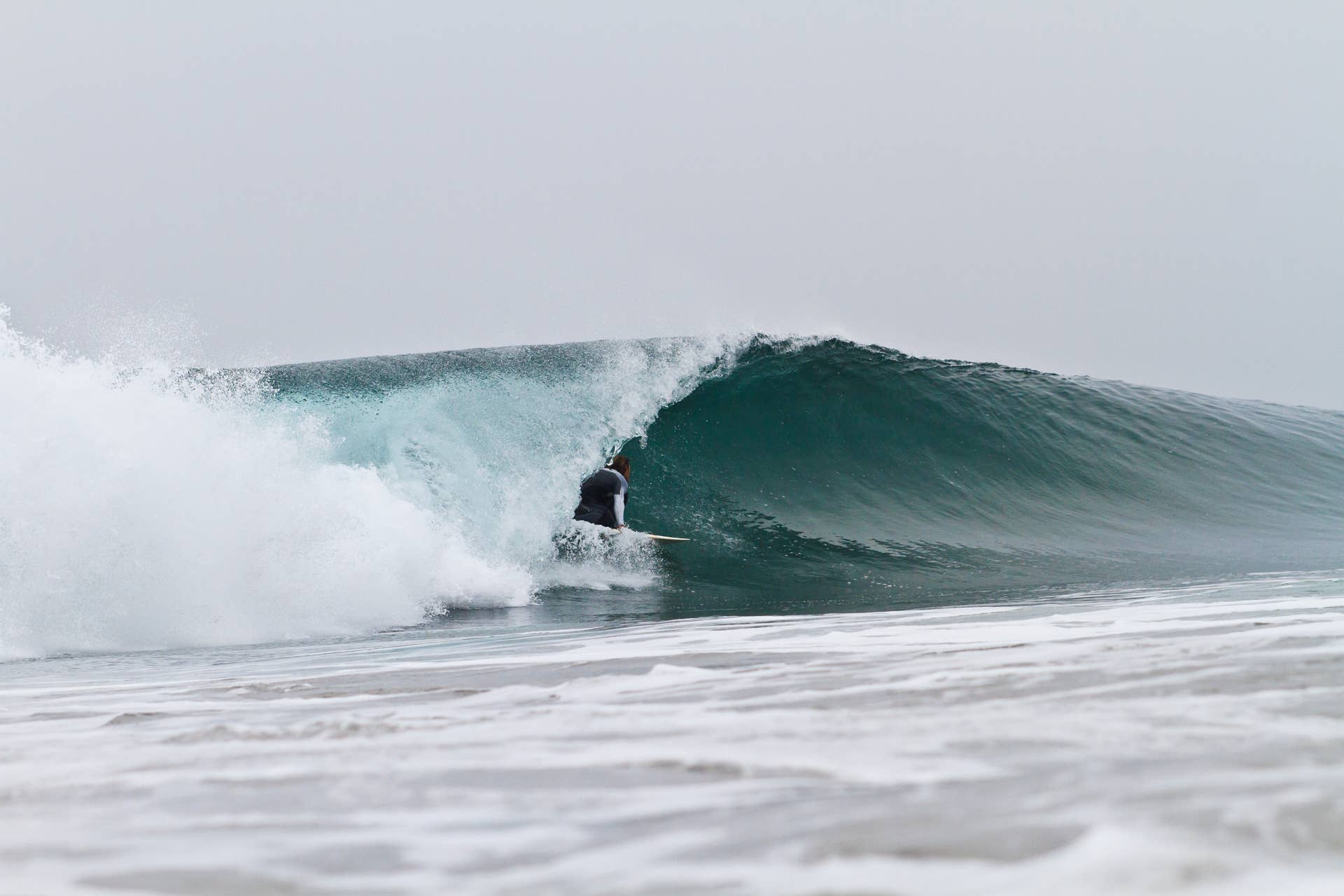
AMERICAS: Sizable surf with good conditions to be found
After propagating through the Pacific Islands, this SW-SSW swell (215-200°) will eventually find it’s way to the Americas. Arrival time for the initial long period forerunners will be over the weekend of May 30th-31st, but we’re likely to see the meat of the swell through the first few days of June.
Many spots throughout Central America, Mexico, and California will see surf rise up to the head high zone during this run, with overhead sets for standouts and occasionally well overhead for select magnets (strongest overall through Central America and Mexico). A freak spot like Puerto Escondido, Mexico may be going XL.
For most regions, the cleanest and most favorable wind conditions are expected during the morning hours each day, before a seabreeze is likely to develop by the afternoons.