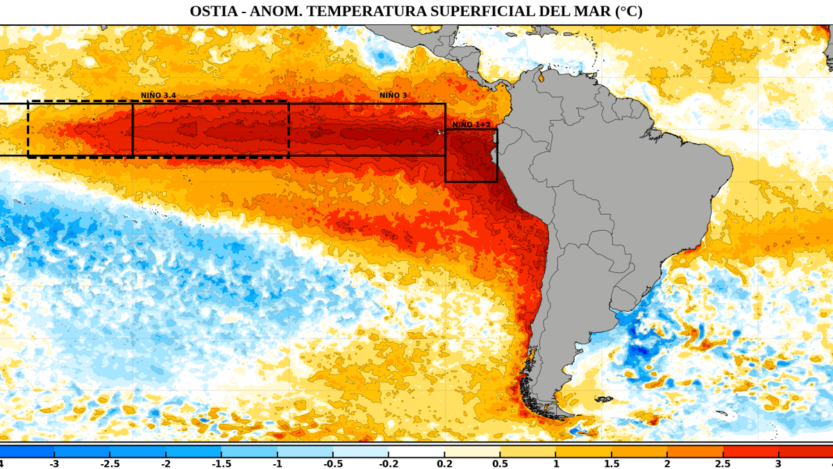
Just when the Pacific’s so-called Super El Niño appeared big enough, the climate phenomenon seems to have sprouted a second arm.
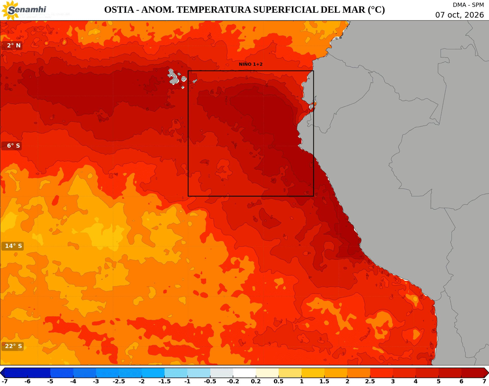
New sea-surface temperature maps show a broad ribbon of abnormally warm water stretching across the equatorial Pacific—and another tongue extending south from Peru and Ecuador toward Chile. Comparing maps from September 30 and October 14, the southern extension appears to have expanded dramatically.
But this is no literal mutant, and “second arm” isn’t an official meteorological distinction. It describes the shape of the warming, not a separate El Niño event.
The concern is the sheer scale of the heat.
In an October 16 bulletin, Peru’s multisector El Niño commission, ENFEN, which includes meteorological agency SENAMHI, reported, translated from Spanish: “Pacific sea-surface temperatures continue to show positive anomalies with an upward trend.”
“This body of water extends toward the southeast and appears to form a second arm connected to the main warming zone,” meteorologists observed, noting that localized sea surface temperatures in the anomaly have surged more than 3°C above historical averages.
Related: Watch: Seawall Collapses at Iconic SoCal Hotel Amid Massive Surf
The commission expects coastal warming off Peru to remain at “extraordinary” intensity through January 2027, while central-Pacific El Niño conditions remain “very strong” into February.
Climate scientist Zeke Hausfather has gone even further. Writing in The Climate Brink, he said: “’I think that this year’s El Niño event is likely to be the strongest in 1,000 years if the latest models of its peak prove accurate.”
That’s a forecast, not a settled record.
What does it mean for coastal communities?
El Niño disrupts trade winds and shifts storm tracks. For Southern California, a strong event can tilt the odds toward wetter winter weather, dangerous runoff, flooding and landslides. Elevated local sea levels, storm surge and powerful surf can combine to accelerate beach erosion and threaten oceanfront infrastructure.
Across Peru, ENFEN forecasts heavier-than-normal rainfall along the northern and central coast, with some rivers running above normal.
The World Meteorological Organization says stronger El Niño conditions raise global risks of flooding, drought and extreme heat. But California climate scientist Daniel Swain warns that even an intense event “does not guarantee specific outcomes in California.”
In other words, the Pacific has revealed another alarming shape. What it delivers this winter remains to be seen. Stay tuned; stay alert.
Related: Massive Cliff Collapse Near PCH Caught on Camera as El Niño Batters California (Video)