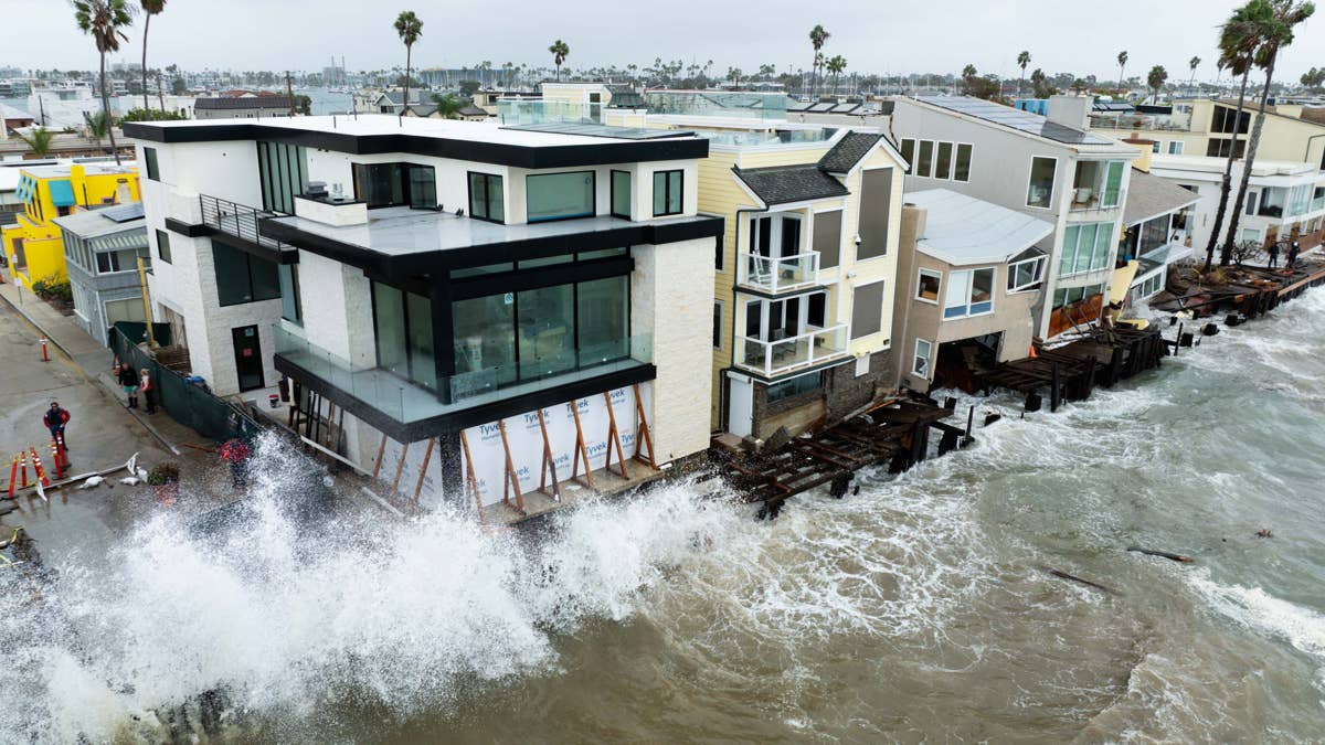
This super El Nino in the Pacific is due to last well into next year. Surf spots across Mexico, Central America and SoCal have felt the impact of this extreme weather event – which could also have wider implications for the world’s climate, if it continues on its current track.
El Niño is having a significant impact on the Pacific – for one, it’s actually turning the water bluer. This is because, during normal conditions, the trade winds help bring cold, nutrient-rich water from deeper layers of the Pacific toward the surface through a process called upwelling.
These nutrients are essential for phytoplankton growth. During El Niño, the trade winds weaken and warm water spreads eastward, reducing the supply of nutrients reaching the surface. With less food available, phytoplankton populations decline – and NASA have noticed this is impacting the water colour. Who knew. But with El Niño in full swing, what else can we expect from this swell season? Let’s take a look.
El Niño’s Just Getting Started
As of earlier this month, NOAA reported that El Nino was strengthening rapidly. Its Niño 3.4 index had reached +2.1°C, with temperatures in the eastern equatorial Pacific substantially higher still. NOAA put the chance of a historically strong event exceeding its defined threshold at 83% for October-to-December. That makes this a serious contender for the strongest El Niño since records began. But that doesn’t necessarily mean a record-breaking surf season – oh no. We can attribute the fact the climate drivers have charged up the playing field for it to take place but there’s still multiple factors that need to come into force before that call’s made. What we do know is; the potential is there.
Related: What Is a Kelvin Wave? And What Does It Mean for California Surf?
Will The Surf Get Bigger?
This is tricky but we can look at historical data to understand where El Nino’s heading. The best comparisons are the winters of 1982-83, 1997-98 and 2015-16. These were the most powerful El Niño events on record.
NASA analysed the 2015-2016 event and in that study, describes how the strong El Niños of 1982-83 and 1997-98 produced large and consistent wave conditions across the North Pacific and US West Coast. A separate peer-reviewed study found that 1997-98 had the highest basin-wide wave energy in its northeast Pacific record, more so than 1982-83.
So what we know is; powerful El Niños can produce unusually energetic, persistent North Pacific wave conditions, everyone knows this. But the evidence doesn’t suggest that bigger always means better surf. We also know that the 1997-98 winter was exceptionally energetic in one long-term northeast Pacific wave record – but even with that data, we cannot put a percentage on how much bigger the surf will be during this season’s event.
Sure, El Niño can produce giant swells – but there’s more going on under the hood. The size of the waves at your local depends on how that swell arrives.
The Pacific Ocean May Rise
El Niño can change the height of the ocean over enormous distances without a conventional wave breaking anywhere. Yeah, it’s trippy. But it’s all to do with the trade winds. Again, the trade winds usually push warm surface water towards the western Pacific, helping maintain a difference in sea level across the basin.
But when they weaken, as they do in El Niño, pulses of warm water move eastwards as enormous, slow-moving features called equatorial Kelvin waves. These can span thousands of miles and deepen the warm layer of the ocean. This changes the thermocline (a transitional layer in the oceans where temperature shifts rapidly with depth) and can raise sea level in parts of the eastern Pacific.
What does that mean for surfing? Well, you can’t surf a Kelvin wave, they’re under the surface. But a combo of higher sea levels, storm surges and large swells can combine to increase coastal flooding and erosion.
The Penguins May Go Hungry
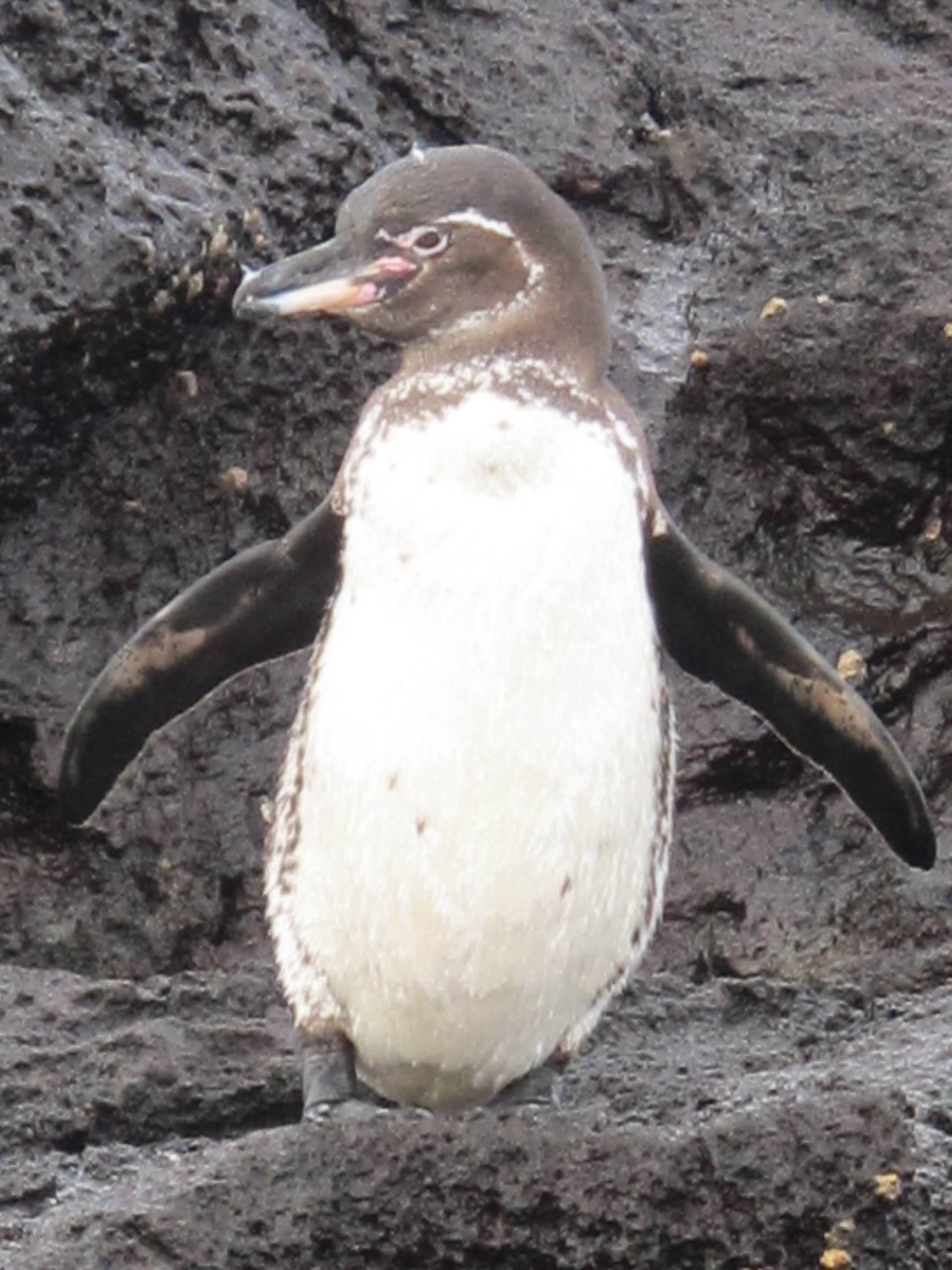
El Nino can cause penguins to go hungry around the Galápagos. Nutrient-poor warm water can disrupt the food chain and some marine animals lose access to their normal food supply. Severe historical El Niño events have caused major declines in wildlife populations. But the good news is, after El Nino, the ocean can make a quick – but not immediate – comeback as phytoplankton concentrations can recover pretty sharply.
El Niño Can Move The World’s Storm Trains
Yes, El Nino is a Pacific event – but the sheer size of it means it can have a crazy impact on the world’s storm tracks. During a strong El Nino, like this season’s Godzilla one, there can be changes in tropical heating which can strengthen and then shift the Pacific jet stream. This can mean more storm activity and rainfall for the Americas while the likes of Australia and Indonesia can experience drought.
The change in the jet stream could bring around some different swell directions too, away from the norm. As well as help generate longer runs of big surf, which could lead to coastal erosion in some areas. It’s important to remember that El Nino sort of rearranges the atmosphere – as opposed to shooting adrenaline into its veins.
Related: El Niño Likely to Be Strongest Ever On Record: Here’s What It Means For Surfing